BGM (Background Map)
To create way and other objects in the scene, a background reference map with the layout drawing of the modeled area is recommended. File format can be either “jpg” or “png”.
The image should include at least one measurable element, such as road width or the spacing between two columns (in meters), which will be used to scale the image accurately to the 3D scene’s dimensions.
Recommended Types
- Digital Scans of Blueprints
- CAD Diagrams
- Satellite Images: Often include a scale marker in one corner.
- Hand-drawn line drawings with a clearly mentioned scale are also acceptable for use as overlays.
When Maps Are Not Available:
- If no suitable images are available, ways can still be defined using the coordinate display located at the top of the main window.
- However, using an image overlay is generally easier and more intuitive.
Examples of Commonly Used BGMs
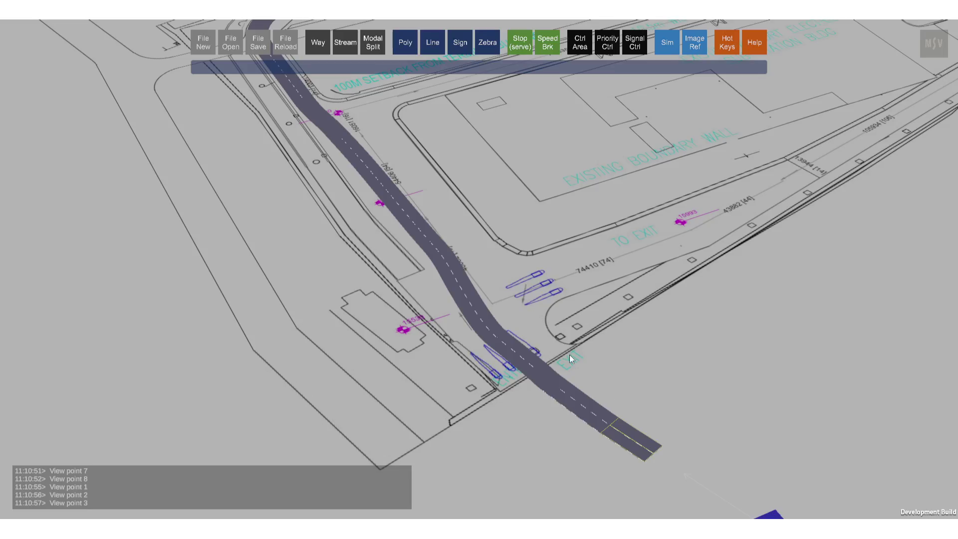
A blueprint used as a reference
A non-CAD image created using basic computer tools is used as reference image
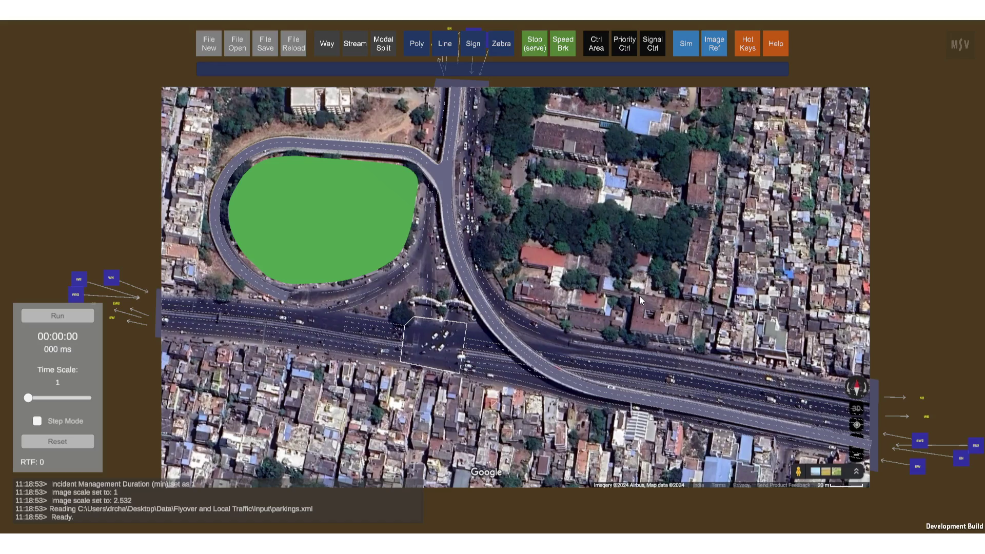
A screenshot of a satellite image (though free satellite images often include vehicles). Once the model is created, the image can be removed or hidden as needed.
These BGMs simplify the process of creating realistic way objects in the scene, ensuring precision and alignment with real-world dimensions.